| Early Ordovician Epoch | ||
| Paleozoic: Ordovician period |
Tremadocian Age |
| Cambrian Age X | Furongian | Early Ordovician | ||
| Floian | Middle Ordovician | Timescale |
| Paleozoic Era Cambrian Period Terrenuevan Epoch Cambrian Epoch 2 Cambrian Epoch 3 (Middle Cambrian) Furongian Epoch (Furongian) Paiban Age Cambrian Age IX Cambrian Age X Dolgellian) Ordovicia Period Early Ordovician Epoch Tremadocian Age Floian Age (Early Arenig) Middle Ordovician Epoch Late Ordovician Epoch Silurian Period Devonian Period Carboniferous Period Permian Period |
As we have introduced the Early Ordovician world fairly extensively on the Early Ordovician page, we will defer to that discussion by way of introduction.

This map is the same as that found on the Early Ordovician page. However, we thought that this would be a good place to talk about the perils of navigating the paleoseas. It might be a good idea to add some scrollwork and illuminated drawings with notices like "Here be dragons," the point being that some of these maps are only slightly better than those produced by medieval cartographers of the European tradition (compare a contemporary Chinese map). The University of Texas gives, as an example, a version from a 1472 edition of the Etymologiae of Isidorus (University of Texas Special Collections site). This is grossly unfair to both Isidorus and medieval (actually Rennaisance) Europeans. "Isidorus" was Bishop Isidore of Seville, who wrote in about 630. Much better maps were created by practical men of commerce in the Fifteenth Century, who certainly didn't rely on Seventh Century clerics for advice on navigation. But, back to our subject.
The Early Ordovician is particularly problematic because so many of the main landmasses were separated by ocean. In some cases, continental latitudes and orientations can be estimated from paleomagnetic data. However, relative longitude is usually established by looking at rock strata which were once shared with adjoining continents. See Dalziel 2005) for a non-technical example of how this is done. That analysis can't be performed if the continents are sparated by deep ocean. Worse, for continents near the equator, even good paleomagnetic data can be misleading, since, without knowing the orientation of the Earth's magnetic field, we can't be sure whether the latitude we calculate is North or South.
You'd think the last problem, in particular, would sort itself out. But compare the positions of Siberia on Jan Golonka's Tremadoc map, or the one reproduced at Jeff Poling's Dinosauria site, with the map from Chris Scotese's Paleomap Project. Plainly, Golonka and Scotese read the paleomagnetic data in opposite senses. That, in turn, affects the position of Greenland -- known to be close by -- which, in turn, causes the North American craton to be rotated to differing degrees. We, of course, fudged the issue and put Siberia squarely on the equator. Ron Blakey's map has partially dodged the issue by moving North America slightly further west, so its orientation isn't so closely coupled to the position of the Siberian terrane.
All of this interacts with the longitude of Baltica, which is unknown because it was not in contact with anything else. Blakey has Baltica in an easterly position, south of Siberia, as does Scotese. However, Golonka places Baltica further west. We followed Golonka; but, as suggested in a note to our map, we probably guessed wrong. One of the few constraints on Laurentia (North America) is that we can be certain that Avalonia, and other slices of western Gondwana, were peeling off Gondwana and hitting the Laurentian coast from Greenland all the way to Texas, beginning in about the Floian. MacNiocaill et al. (1997). That can't work if Baltica is in the way.Similarly, Iberia, France, and other eastern fragments of Gondwana were scheduled to dock with Baltica. So, all things considered, Baltica ought to be off to the east by a significant margin. Otherwise, the Alhambra ends up being built in Tomsk, where it would look somewhat out of place.
ATW051008, last revised ATW080130. Text public domain. No rights reserved.
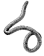 |
image from |
Palaeoscolex piscatorum
Tremodocian
England
 |
image from Teichert 1988 |
Protocycloceras sp.
Phylum : Mollusca
Class: Cephalopoda
Subclass: Palcephalopoda
Infraclass: unspecified
Order: Ellesmerocerida
Family: Protocycloceratidae
shell length about 9 cm
Tremadoc
Laurentia (USA)
